#15 · 秋田縣Akita · 北秋田市Kitaakita
森吉山阿仁Moriyoshi-zan Ani
阿仁スキー場

丹尼斯指數Dennis Index2 爽到了值得二刷2 Worth a second run
雪場資訊Resort info

開放狀況待確認Season status to be confirmed
山上有樹冰與長滑道。Snow monsters and long runs from the gondola top.
- 縣/地區Prefecture / area
- 秋田縣 · 北秋田市Kitaakita · Akita
- 標高/落差Elevation / vertical
- 山腳 537 m・山頂 1,200 m・垂直 663 mBase 537 m · top 1,200 m · vertical 663 m來源source
- 纜車Lifts
- 3 座3來源source
- 最長滑道Longest run
- 4.4 km來源source
- 2026-27 開放日2026-27 opening
- 未整理Not compiled yet
- 地形公園Terrain park
- 官方未見公園資訊,以樹冰為主No park info on official site; known for snow monsters來源source
- 票價Lift prices
- 未整理Not compiled yet
雪道圖Trail map
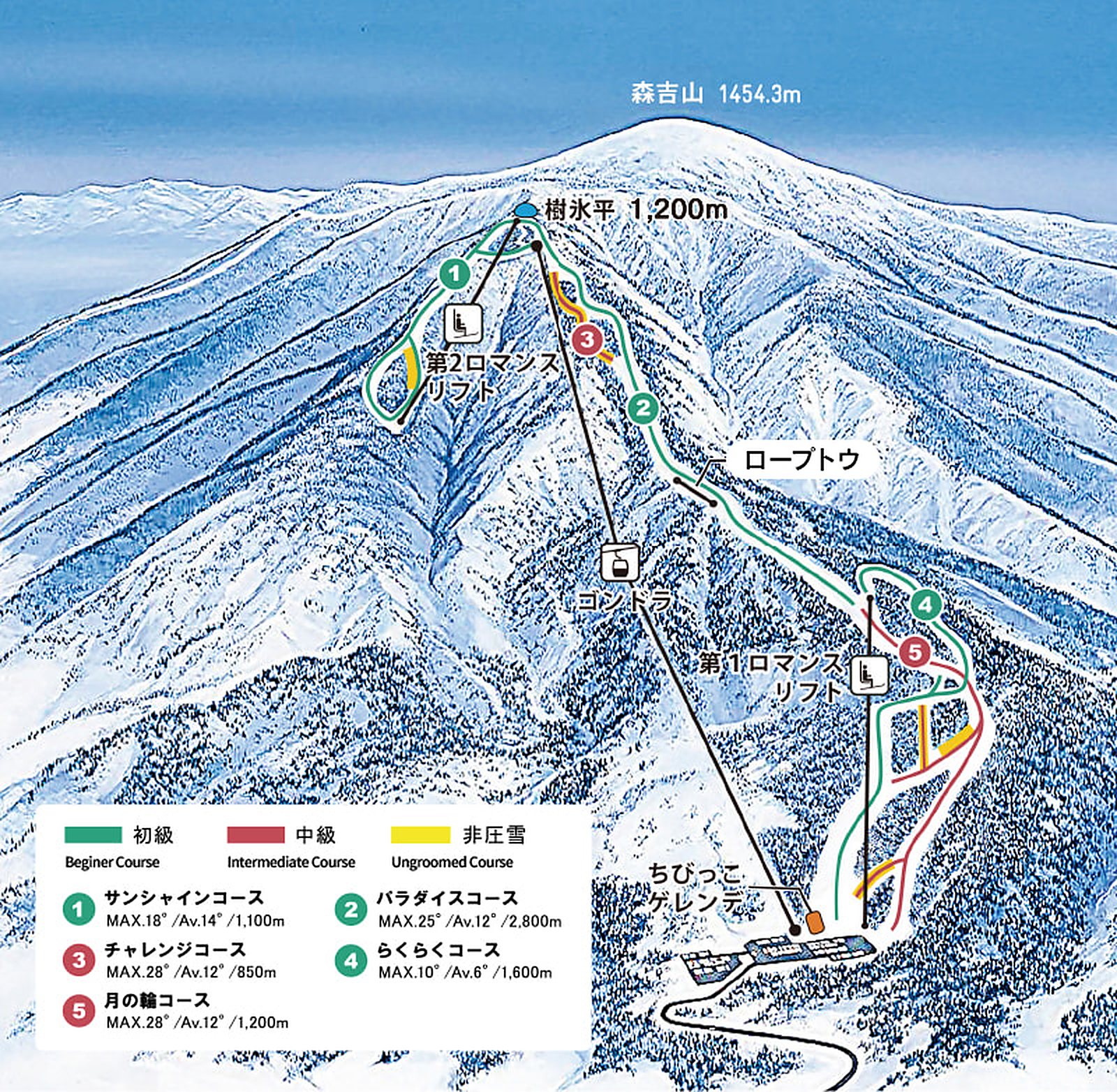 點圖看大圖Tap to enlarge
原圖解析度較低,已放大處理,細節可能略糊Low-res original, upscaled; fine detail may be soft
圖片來源:雪場官方Image source: official ski field · 著作權屬各雪場,本站僅縮小轉載供參考。Copyright belongs to the resort; shown reduced for reference only.
3D 雪場地圖3D map
全螢幕 / 新分頁開啟Full screen / new tab拖曳旋轉、滾輪或雙指縮放。3D 地圖為非官方,來自「東北 3D 雪場地圖版本庫」(3DMap-0009)。Drag to rotate, scroll or pinch to zoom. Unofficial 3D map from the Tohoku 3D library (3DMap-0009). tohoku-3d.pages.dev